When conservationists, ranchers, sportsmen, river runners, dirt bikers, county officials and others came together to form the Owyhee Initiative in the early 2000s, a shared love of open space was a key ingredient that kept the group working together. We realized the importance of access to the area for recreationists, ranchers, and the greater community. We worked together to create cherry stems through Wilderness areas to ensure that the public could still drive to iconic overlooks and river access points while protecting the surrounding landscape.
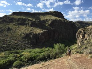
We also recognized that there were examples of “excess” access: hill climbs that were eroding soils, redundant trails that were impacting habitat for rare plants, and cross-country travel that was bumping big game out of preferred habitat. When the dirt roads are wet, they turn into “Owyhee gumbo” that can swallow vehicles up to their axles, leaving motorists stranded.
This is why way back in 2006 the Owyhee Initiative Agreement asked that the BLM create travel plans that “include a multiple use recreational route system that provides a wide range of recreational opportunities and experiences for all users while protecting natural and cultural resources.”
Here are some other excerpts from the Agreement:
Travel Management: The Bureau of Land Management (BLM) will fulfill its responsibility to develop and implement travel plans for the BLM managed lands outside of wilderness areas in Owyhee County within specified time frames. All public land users are expected to benefit from improved safety, route maintenance, maps, signs, education, and new opportunities provided by establishment of travel route systems.
Designation of Routes: The Travel Plans will be based on resource and route inventories, will include designation of routes and route systems that are open or closed, and will include, but not be limited to the following management approaches – trail construction, (including reconstruction), road and trail closure, seasonal closures or restrictions, types of use allowed, restoration of disturbed areas, monitoring, maintenance, maps, signs, education and enforcement. Travel Plans will consider whether a road or trail is appropriate.
The 2009 Public Lands Omnibus Bill, championed by Sen. Crapo and signed into law, officially endorsed the group’s recommendations and stated, “It is the intent of Congress that, not later than 3 years after the date of enactment of this Act, the Secretary shall complete a transportation plan for Bureau of Land Management land in the County outside the Owyhee Front.”
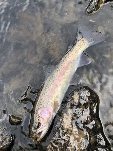
Although the Travel Management Plans were not completed by 2012, the BLM has since completed an inventory of existing routes and is now moving forward with travel management, starting with the Canyonlands East planning area. This area spans both sides of Highway 51, starts at the Nevada border, goes north to the Roberson Trail West, and extends from the Bruneau River Canyon in the east to the Williams Northwest gas pipeline/Little Jacks Creek Wilderness boundary to the west. This sagebrush steppe area supports important habitat for Greater Sage grouse, pronghorn, redband trout, and other wildlife species.
The completed BLM inventory documented a mix of historic and user-created routes in the planning area totaling 1,422 miles – enough to drive from the Owyhee County seat of Murphy to Las Vegas and back.
The BLM has put forward several travel management options for the Canyonlands East area. Alternative B has 511 miles of routes, Alternative C has 852 miles, and Alternative D has 1,101. Some of these routes include timing restrictions in specific areas to protect Greater sage-grouse in the spring (March 25-May 15, 5:00 am-9:00am) and seasonal closures for bighorn sheep lambing areas (April 15-June 15, 24 hours).
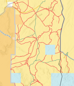
We are asking ICL members to voice their support for Alternative B, which provides the maximum natural and cultural resource protection with the lowest number of designated motorized travel routes:
“Overall, Alternative B provides seasonal protection for Greater sage-grouse during critical life stages and would reduce current adverse impacts on breeding success and habitats necessary for winter survival. Additionally, fragmentation of crucial habitat would be reduced, along with potential for invasion of non- native species that may alter species composition and increase the risk of wildfire.” Canyonlands East EA p. 53.
ICL will be meeting with other members of the Owyhee Initiative to get their perspectives on which trail system constitutes reasonable access and resource protections for the County, sportsmen, river runners, local ranchers, community members, and others and we may recommend additional changes to Alternative B.
You can find more information on the BLM’s website here. Comments are due August 24. Take Action at the link below – and thank you for speaking up for the Owyhee Canyonlands!
